
Asset Management Manual
A guide for practitioners!

Asset Management Manual
A guide for practitioners!
The state government of Pahang, Malaysia, decided to implement a road asset management system for its state road network as part of a long-term road maintenance contract of seven years with a private company appointed in April 2013. The company was to maintain 2,300 km of the state road network and implement a road asset management system. The scope of road maintenance work included routine maintenance, periodic maintenance, and emergency maintenance. The contract also included the provision of an asset management system (YP-RAMS) and a road asset inventory management system (YP-RIMS).
The data collection for the asset management system involved the collection of road asset inventory data and a pavement condition survey to be carried out for the entire network in the first year. The collection of road asset inventory data and a pavement condition survey for 30 percent of the network was to be carried out from the second year until the end of the contract period. The use of GPS coordinates and digital recording for all asset points and referencing was compulsory. The road asset inventory management system needed to be updated and inventory reports produced every year. The new road asset management module needed to be inter-phased or integrated into a pavement management system, geographic information system (GIS), road asset inventory management system, and road inventory and road condition database.
The asset management software system makes use of a common inventory and database on the ArcGIS platform. The network condition data are measured in accordance with the International Roughness Index (IRI), cracks, and pavement strength. Digital recordings of the right-of-way were taken for the entire network. Traffic data were collected from selected traffic count stations in terms of AADT and axle loading.
The project managers opted to outsource the data collection equipment rather than purchase new equipment. This proved to be cost-effective, considering the idle time between data collection intervals. The techniques and equipment used included a multi-laser profiler and automatic crack detection (ACD) system, FWD, asphalt coring, and a dynamic cone penetrometer. The techniques and equipment used are shown in Figures 2.1.5.1 and 2.1.5.2 The following data were collected:
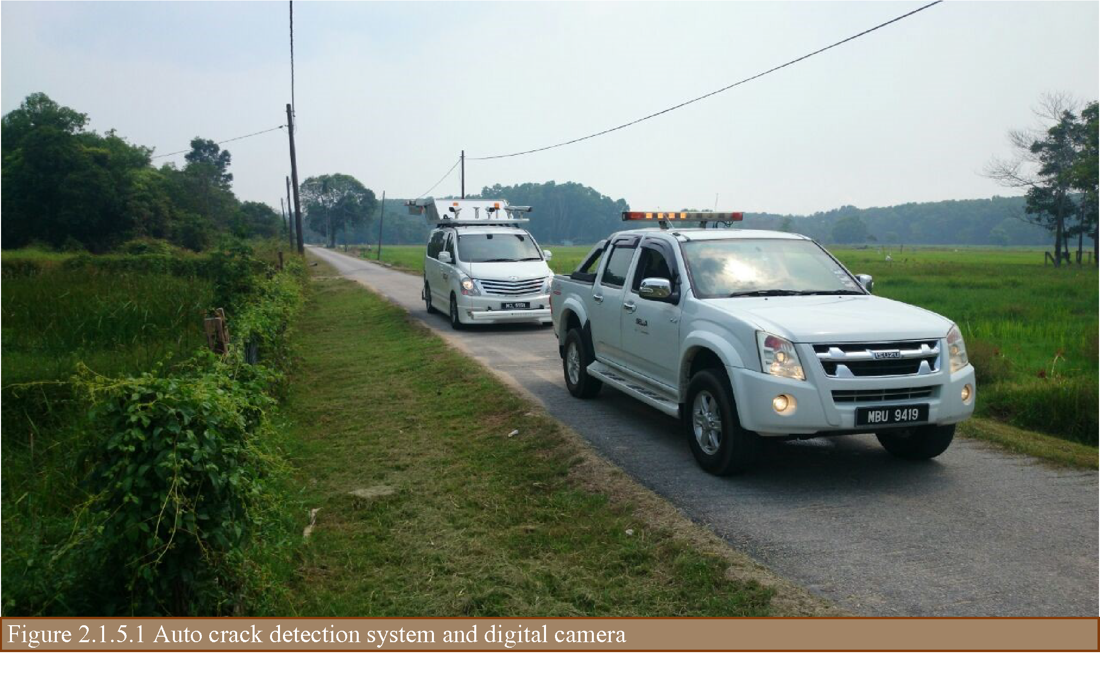
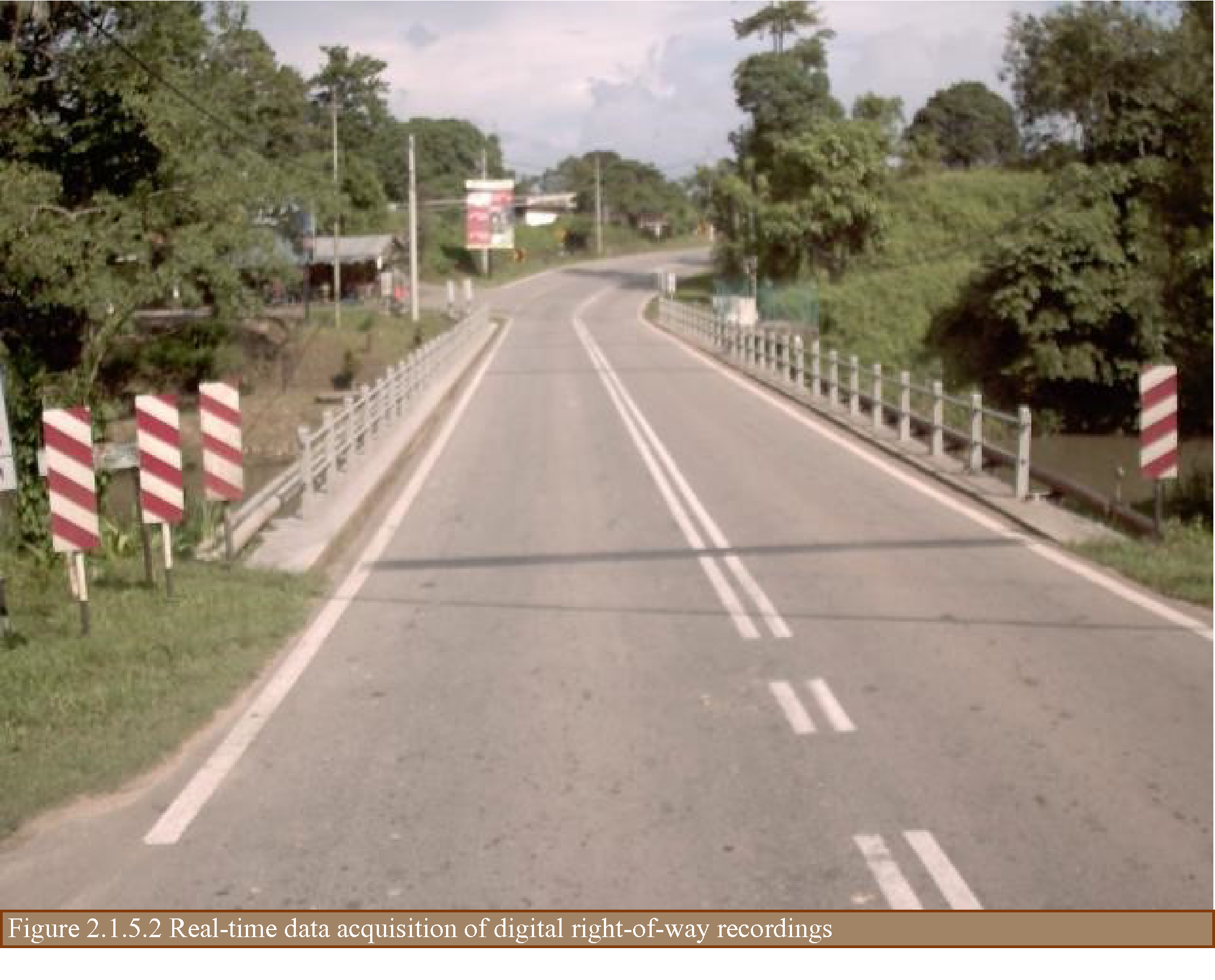
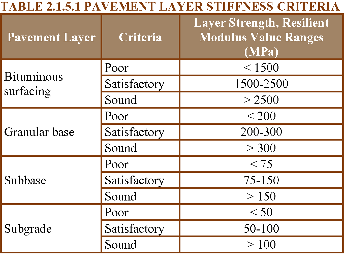
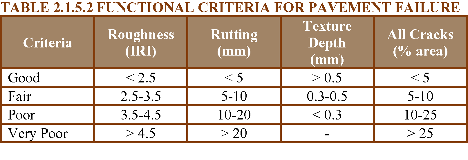
The criteria used for data collection and analysis are shown in Tables 2.1.5.1 to 2.1.5.3.

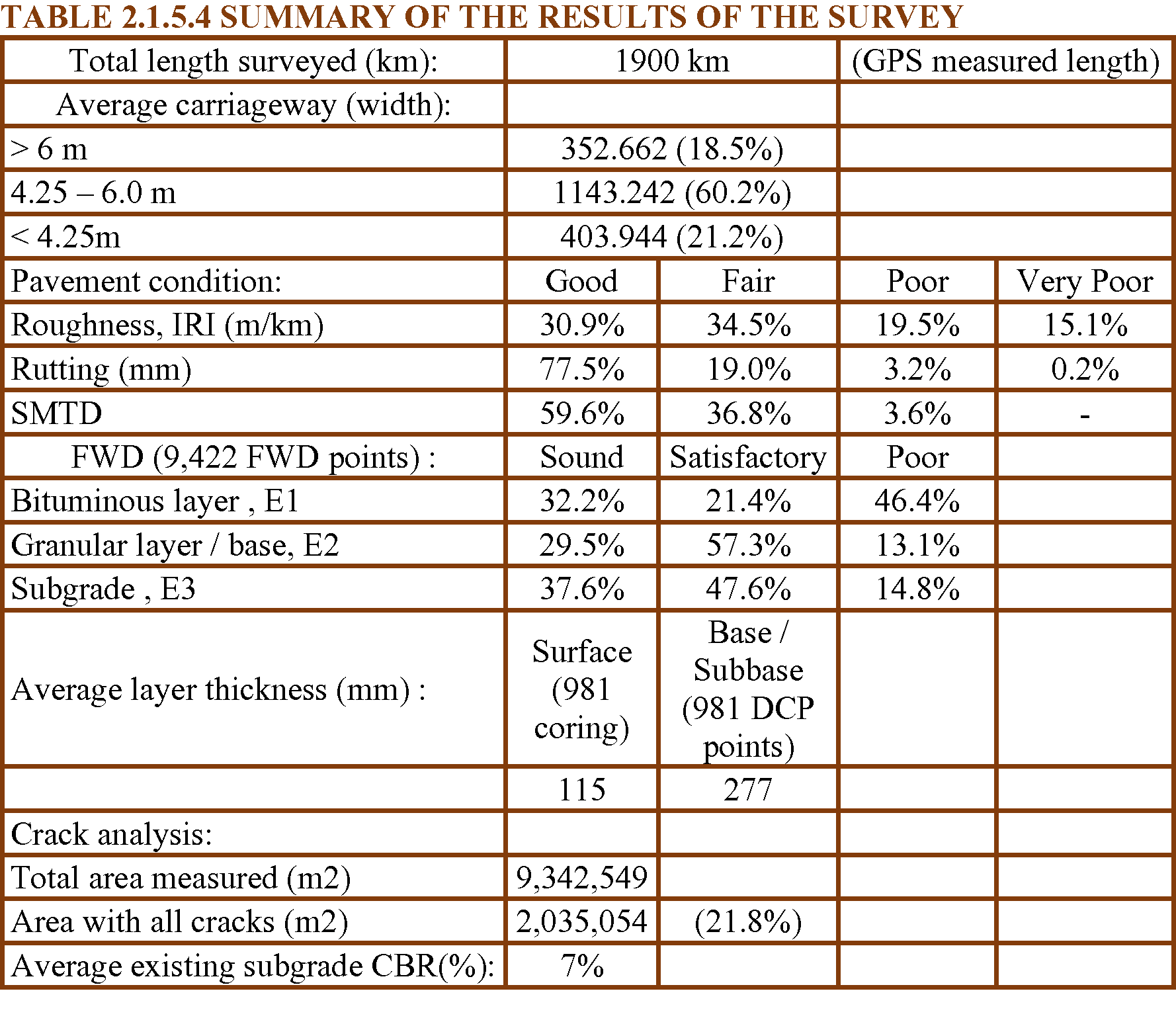
The collected road data were processed using the respective software of the equipment used. A summary of the outcome of the surveys is shown in Table 2.1.5.4.
HDM-4 (Bennett 1999, 2007) was used to evaluate the maintenance requirements based on the maintenance standard specified. With the base year 2014, the predicted cost by each district is shown in Figure 2.1.5.3.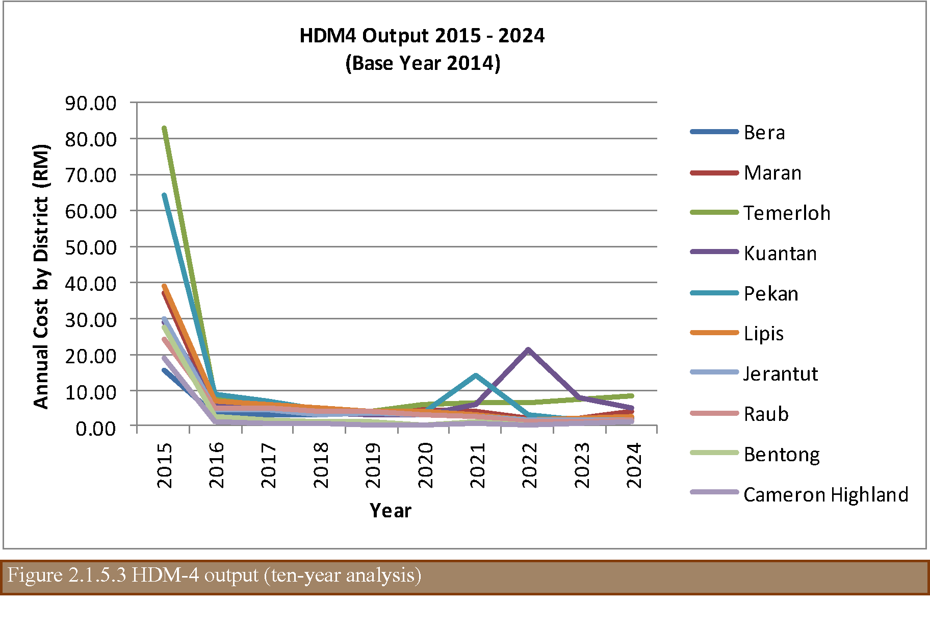
In conclusion, the proper and systematic collection of data using the correct and appropriate data collection equipment allows an adequate maintenance strategy to be applied.